By Jeffrey Meehan and Carly Sauvageau, Reno Gazette Journal
A potentially historic El Niño is developing in the Pacific Ocean, and forecasts show it could increase the chances of a wetter-than-normal winter around Lake Tahoe and the Sierra.
But that does not guarantee a blockbuster Sierra snow season.
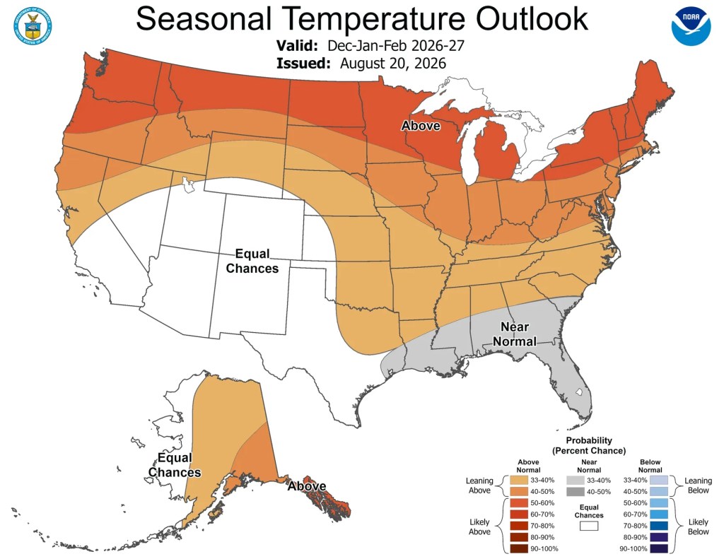
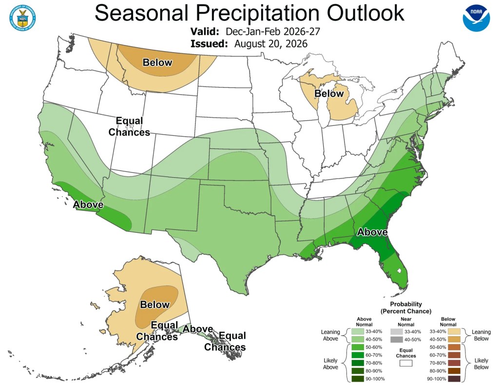
The National Weather Service’s winter outlook favors above-normal precipitation around Tahoe from December through February. It also favors above-normal temperatures.
Past El Niño winters around Tahoe have delivered everything from heavy precipitation to dry conditions.
What is the winter forecast for Lake Tahoe?
The Climate Prediction Center’s report shows above-normal precipitation across most of California during December, January and February.
The greatest chances for above-normal precipitation are in Southern California, but the forecast also favors wetter conditions through the Sierra and around Lake Tahoe.
The Aug. 20 outlook also favors above-normal temperatures across Northern California and much of the northern United States.
How will El Niño affect Tahoe this winter?
El Niño is strengthening, with a greater than 90% chance of becoming a very strong event during fall and winter, according to the Climate Prediction Center.
El Niño is a recurring climate pattern marked by warmer-than-normal water in the central and eastern tropical Pacific and weaker winds along the equator. Those changes can affect rainfall and weather around the world. In the United States, El Niño generally pushes the jet stream south, favoring wetter winters in the South and warmer, drier conditions farther north.
During the El Niño-Southern Oscillation cycle, surface temperatures across a large part of the tropical Pacific typically warm or cool by 1 to 3 degrees Celsius (1.8 to 5.4 degrees Fahrenheit) compared with normal.
From October through December, there is a 69% chance the three-month El Niño index will reach 2.5 degrees Celsius (4.5 degrees Fahrenheit) or higher, surpassing all previous events dating to 1950.
“With an event of this magnitude, the chances of experiencing impacts consistent with El Niño are larger, but they are not guaranteed,” the Climate Prediction Center said in its August El Niño discussion.
El Niño is expected to play a larger role as winter progresses. The Climate Prediction Center says the chances for above-normal precipitation increase across much of California later in the season.
Does El Niño mean more snow for Lake Tahoe?
The national El Niño pattern becomes less reliable around Northern California and Tahoe.
The National Weather Service in Sacramento says there is little correlation between precipitation and most El Niño and La Niña patterns in Northern California. Southern California has a much stronger tendency to receive above-normal precipitation during El Niño.
The UC Berkeley Central Sierra Snow Lab, at 6,894 feet, found similarly mixed results when it examined snowfall during nine strong or very strong El Niño seasons.
Four seasons produced above-median snowfall at the lab near Donner Summit, three finished below the median and two were roughly at the median. Snowfall ranged from 236 to 671 inches, compared with a median of 376 inches since 1950.
The very strong El Niño seasons generally produced average to above-average snowfall, but the lab cautioned that the sample was small. It called the coming winter “still a toss-up.”
What does the Old Farmer’s Almanac predict?
The Old Farmer’s Almanac also predicts a warmer and wetter winter across its Pacific Southwest region, which includes the Tahoe area.
The publication forecasts near- to above-normal snowfall in mountain areas. It identifies late December, mid-January, early and late February, and early and late March as the region’s stormiest periods.
The Almanac says its long-range forecasts combine solar science, climatology, meteorology, historical weather patterns and large-scale climate patterns.
Its forecast is separate from the federal government’s probability-based seasonal outlook, but both favor a relatively warm winter with increased precipitation around Tahoe.
USA TODAY Network via Reuters Connect