1000Photography/Shutterstock
From towering trees and shimmering lakes to tipsy tourists with yard-long margaritas, these seven scenic byways provide a glimpse at Nevada’s diverse scenery.
Nevada is home to 20 scenic byways designated by the Nevada Department of Transportation. These byways represent the Silver State’s unique natural, cultural, historical, or recreational qualities and provide a rich experience for those who traverse them.
Whether admiring towering trees and shimmering lakes or gaping at tourists with yardlong margaritas, these seven scenic byways provide a glimpse at the diverse scenery of Nevada.
1. Angel Lake Road
State Route 231, off Interstate 80 at Wells
A paved scenic byway in Northeastern Nevada since 1995, Angel Lake Scenic Byway meanders upwards 8,500 feet through sagebrush, aspen, and pine, offering sweeping views of the East Humboldt Range in central Elko County. It’s an 11.7-mile drive to the glacier-formed Angel Lake at the top and back down to Wells.
On this drive, you may spot wildlife like bighorn sheep, mountain goats, yellow-bellied marmots, mule deer, and migratory birds. Hiking trails are free to explore, and fishing at the lake costs $5.
Angel Lake Scenic Byway opens annually around May and closes in winter when the snow gets too heavy, though you’ll be able to see snow in the mountain peaks and reflected in the lake’s clear waters as early as June. It’s a steep journey, so keep that in mind.
2. Lamoille Canyon Road
National Forest Road 660, off State Route 227 before Lamoille
Also quaintly tucked in the state’s Northeast corner in Elko County, Lamoille Canyon Scenic Byway winds around the nearly 12,000-foot Ruby Dome in Nevada’s wettest mountain range, the Ruby Mountains. The 12.5-mile byway passes through a glacier-carved canyon, climbing to 8,800 feet, past vibrant meadows popping with colorful wildflowers, wildlife, and waterfalls, and then back again.
This paved drive offers a four-stop self-guided auto tour with geology interpretive exhibits. Hiking and fishing opportunities, picnic areas, and campgrounds are plentiful. You also may spot wildlife like bighorn sheep, mountain goats, and migratory birds.
Lamille Canyon Scenic Byway is located about 22 miles south of Elko. Depending on weather conditions, it is usually open from May through October, but the lower portion may be open year-round.
3. Mt. Rose Highway
State Route 431, Reno to Incline Village
Rising 8,911 feet into the Lake Tahoe Basin in the Sierra Nevada, Mt. Rose Scenic Byway is a paved, 22-mile one-way drive from the desert sagebrush of Reno to the mountainous slopes and ponderosa pines of Mount Rose Wilderness (or the other way around) with expansive views of the Washoe Valley and sparkling Lake Tahoe.
When you reach Tahoe Meadows at the top of the pass, you’ll have access to popular hiking, biking, and skiing trails, including a 1.3-mile handicap-accessible trail. You’ll also pass ski resorts, mountain-style homes, country clubs, and scenic pullovers.
Mt. Rose Scenic Byway is open year-round, depending on the weather. It does get snowy in the winter.
4. Lake Tahoe East Shore
State Route 28 at the Nevada-California Stateline
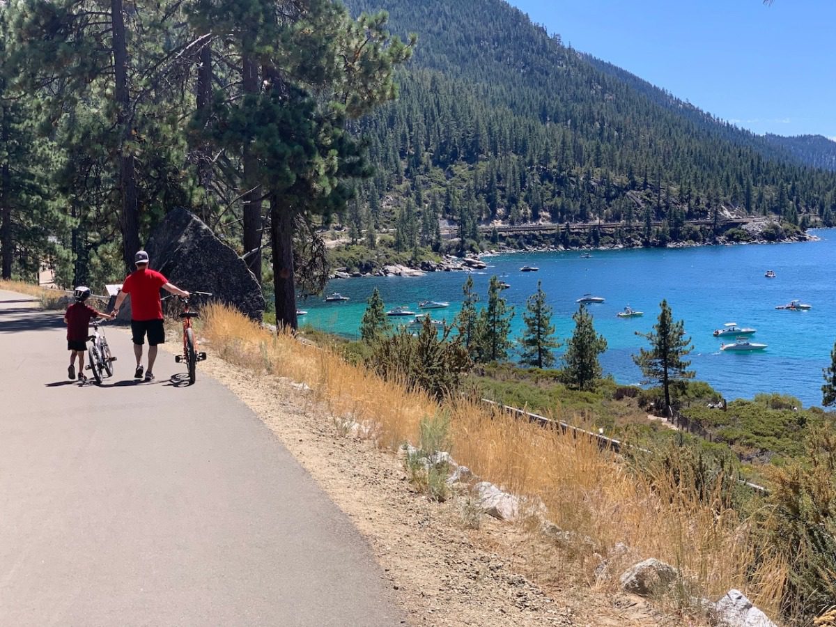
A 28-mile underdeveloped drive along the northeastern shore of North America’s largest alpine lake, the Lake Tahoe East Shore National Scenic Byway is known as “America’s Most Beautiful Bikeway.” It’s also a historic path, part of the Pony Express Trail, and home to the sacred grounds of the Washoe Indians.
This spectacular byway has direct access to the public beaches, coves, and trails along the sparkling blue Nevada shoreline. Points of note include Crystal Bay, Lake Tahoe State Park’s Sand Harbor Beach State Recreation Area, and Thunderbird Lake Tahoe Historic Site. Gorgeous panoramic views don’t hurt the drive, either.
Lake Tahoe East Shore National Scenic Byway is open year-round.
5. Valley of Fire Road
State Route 169 through Valley of Fire State Park, off I-15
There’s nothing quite like the red sandstone rock formations at Nevada’s oldest and largest state park, Valley of Fire. Located about 58 miles from the Las Vegas Strip, the paved, 7-mile Valley of Fire Scenic Byway runs west to east past trails, canyons, petroglyphs, desert viewpoints, and colorful formations like Arch Rock and Elephant Rock.
Along with the Valley of Fire Visitor’s Center, there are many places to park along this drive for expansive views, photo opportunities, and trailheads. White Domes Road, a 5.5-mile one-way road, intersects with the byway, providing access to even more outdoor recreational opportunities, including hiking, camping, and picnicking.
Admission to Valley of Fire State Park is $10 for Nevada residents. While the byway is typically open year-round, trails sometimes close during summer’s extreme heat. Additionally, Valley of Fire State Park will be closed for improvements from December 2–15, 2024.
6. Red Rock Scenic Drive
State Route 159, near Charleston in the north and Blue Diamond in the south
Only 20 minutes from the Las Vegas Strip, Red Rock Canyon National Conservation Area sits on nearly 200,000 acres of geological beauty. The 13-mile, one-way scenic drive around Red Rock passes rolling sandstone ridges, steep-walled canyons (some up to 3,000 feet high), wildlife, vegetation, and cultural history.
The drive through this dramatic landscape, also a popular bike route, starts at the visitor center and passes many recreational opportunities, including hiking, rock climbing, horseback riding, mountain biking, road biking, and picnicking. There are 12 parking areas and 21 different trails.
Take this drive any season, and you’ll see why Red Rock attracts more than three million visitors annually.
7. Las Vegas Strip All-American Road
South to north on Las Vegas Boulevard, from the Welcome to Las Vegas Sign to The Strat (or vice versa)
The Las Vegas Strip is America’s first and only “Nighttime Scenic Byway.” A drive on this All-American Road takes you past 4.5 miles of glitzy resorts, neon lights, and drunken tourists.
When you cruise this national treasure, you’ll pass sites like an Egyptian pyramid, a medieval castle, the New York City skyline, and the Eiffel Tower–just to name a few. You might even catch the world-famous Bellagio Fountains in action.
The Las Vegas Strip is an evolving byway. Subtractions like the recent implosion of the historic Tropicana Hotel and additions like the future A’s baseball stadium or a guitar-shaped Hard Rock Hotel tower can change the entire Las Vegas skyline.
This article first appeared on Good Info News Wire and is republished here under a Creative Commons license.
READ MORE: 7 cozy Lake Tahoe cabins to book this fall

30+ Valentine’s Day events in Nevada, from a Shrek Rave to hot air balloon elopements
There are plenty of ways to feel the love on Valentine’s Day, whether you’re spending it with your significant other, your friends, or yourself....

Nevadan things to do (week of 2/2-2/8)
Looking for something to do this week? We’ve rounded up Galentine's, Super Bowl, outdoorsy and artsy events, and opportunities to support your...

Spring in the Silver state: 38 festivals to look forward to
There are scores of Nevada festivals happening this spring. No matter what your interests are, you’re sure to find one that’s right up your alley....

Nevadan things to do (week of 1/26-2/1)
What’s happening in Nevada this week? Seed swaps, opera, chocolate factory tours, opera, local markets, and cowboy poetry. If you’re signed up for...

8 NV nonprofits to support during Slavery & Human Trafficking Prevention Month
By providing safe housing, spreading awareness, or partnering with law enforcement, these Nevada organizations are devoted to combatting human...

Honor Martin Luther King Jr.’s legacy at these Nevada events
Martin Luther King Jr.’s peaceful message takes center stage at a variety of MLK Day events in Nevada, including a grand parade, a 5k run, and a day...


